UPDATE December 2009: The Forest Way is now open between Hartfield & Balls Green following bridge replacement.
Parking
Click to expand
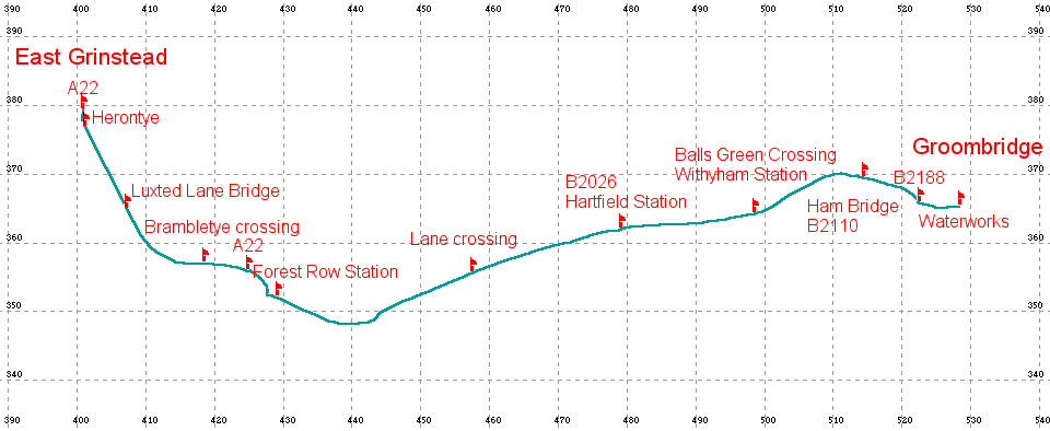
map| Location | Distance (KM) |
|---|---|
| A22 | 000 |
| Herontye | 0.265 |
| Brambletye Crossing | 3.098 |
| A22 Forest Row | 3.746 |
| Forest Row Station | 4.376 |
| Lane crossing | 7.462 |
| B2026 HARTFIELD STATION | 9.717 |
| Balls Green Crossing Withyham Station | 11.662 |
| Ham Bridge B2110 | 13.394 |
| B2188 Near Groombridge | 14.303 |
| Groombridge Water Works | 14.905 |
Once again, this follows the track bed of a disused railway, this time from East Grinstead towards Tunbridge Wells skirting the Ashdown Forest for some 8 miles. The start can be found at the southern end of the High Street by the roundabout, where the main road goes into the old railway cutting, Beeching Way, now used as an inner bypass. Sustrans have developed this route as part of their Millennium project. Parking is easy in one of two large car parks behind the church.
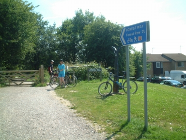 The first few
hundred yards are along a path within a housing estate, but once
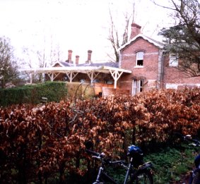
Herontye road is crossed, you are into open country with glimpses of
the old Herontye house to your right. The track has recently been
resurfaced and is very pleasant to ride on. At the Start is an
NCN milepost
The first few
hundred yards are along a path within a housing estate, but once
Herontye road is crossed, you are into open country with glimpses of
the old Herontye house to your right. The track has recently been
resurfaced and is very pleasant to ride on. At the Start is an
NCN milepost
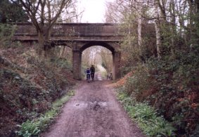
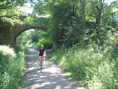 Shortly after going under a brick bridge, Weir Wood reservoir can be
seen on the right. The next landmark is the ruins of Brambletye house,
which can be seen by climbing the banks to some picnic benches about
1/2 mile further on.
Shortly after going under a brick bridge, Weir Wood reservoir can be
seen on the right. The next landmark is the ruins of Brambletye house,
which can be seen by climbing the banks to some picnic benches about
1/2 mile further on.
You have to cross over a farm road at the old Brambletye Crossing.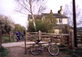 The track then runs behind some houses to the main road.
This must be crossed but since this is the main route to the coast at
Eastbourne it is busy and on a bend, however a Pegasus crossing has now
been installed which makes crossing here much safer. Go straight over
into a farm lane, sign posted Tablehurst farm, go up past the water
works and then follow the marked way which is quite narrow behind some
buildings on your right.
Some of which were part of the Forest Row station. A photo can be found
here You soon come out onto the track bed again
and cross the river medway.
The track then runs behind some houses to the main road.
This must be crossed but since this is the main route to the coast at
Eastbourne it is busy and on a bend, however a Pegasus crossing has now
been installed which makes crossing here much safer. Go straight over
into a farm lane, sign posted Tablehurst farm, go up past the water
works and then follow the marked way which is quite narrow behind some
buildings on your right.
Some of which were part of the Forest Row station. A photo can be found
here You soon come out onto the track bed again
and cross the river medway.
The track runs behind some gardens and allotments on the right and the
River Medway on the left
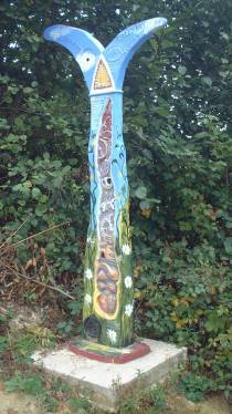
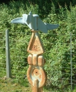
Along the forest way there are a number of Sustrans National Cycle Network
(NCN) signs.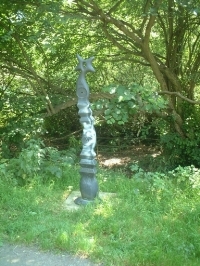
 then out into open country. The route now runs parallel
to the River Medway on the left and there are glimpses of Ashdown
Forest on your right.
then out into open country. The route now runs parallel
to the River Medway on the left and there are glimpses of Ashdown
Forest on your right.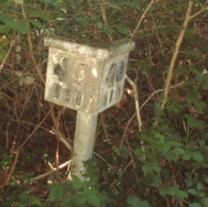
Occasionally old railway trackside furniture can be seen.
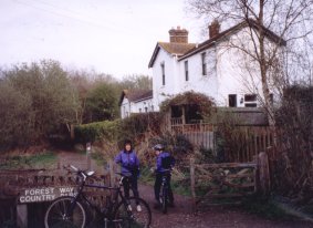
About 3 miles after Forest Row, the railway goes under the B2026 at Hartfield and past a station which has been converted into a private house necessitating a short diversion off the track bed or to see it how it was with the track look here.

Compare this recent picture with the one on
Kevin
Murphy's site taken when the railway was still in use.Another
photo can be found here.
 In a mile, after going under another bridge the B2110 has
to be crossed close to where Ham bridge has been dismantled, there is a
limited amount of parking in a lay-by here. The track continues along
the old trackbed but after a few hundred yards bears away when the old
track joins the existing Oxted to Uckfield line. The track bears down
to cross the B2188 and then continues parallel to the railway for a
while before going under a small tunnel and finishing at the
Groombridge - Eridge road by the waterworks Sign at Groombridge.
In a mile, after going under another bridge the B2110 has
to be crossed close to where Ham bridge has been dismantled, there is a
limited amount of parking in a lay-by here. The track continues along
the old trackbed but after a few hundred yards bears away when the old
track joins the existing Oxted to Uckfield line. The track bears down
to cross the B2188 and then continues parallel to the railway for a
while before going under a small tunnel and finishing at the
Groombridge - Eridge road by the waterworks Sign at Groombridge.
| Home | Updated ... 12/09/2007 |